Offline GPS navigation & maps of 66 countries. Try popular navigation for free!


Navitel Navigator 11 is a precise offline GPS navigation, up-to-date online services, and detailed maps of 67 countries and territories of the world. 7 days free.
ADVANTAGES
• Modern user-friendly interface
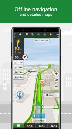
• Offline maps. To work with the program and maps, you do not need the Internet: savings in roaming and independence from the quality of communication in the regions
• Navigation maps with a high level of detail
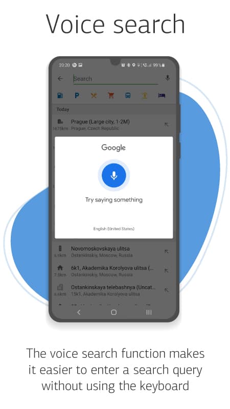
• Voice search
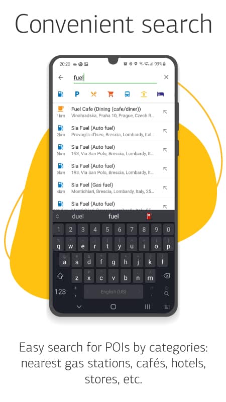
• Easy and convenient POI search by category
• Visual and voice guidance along the route
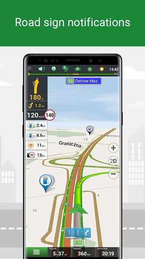
• Actual information about road warnings, potentially dangerous places, speed cameras, road restrictions, etc.
• HUD (Head-Up Display)
• Detailed navigation maps of 67 countries and territories of the world are available for purchase.
SPECIAL FEATURES
FEATURES
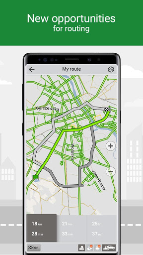
• Fast route calculation. Instant calculation and routing of any length and complexity.
• 3 alternative routes with distance and travel time information.
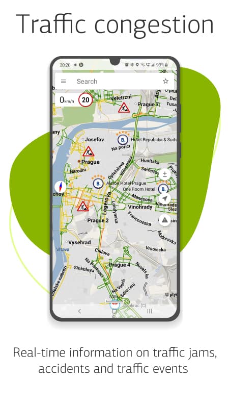
• Navitel.Traffic. Information on all traffic jams in the covered area, available in real-time.
• Navitel.Events. Road accidents, road works, speed cams, and other events marked on the map by users.
• SpeedCam warnings. Information on radars, video recording cameras, and speed bumps.
• 3D Mapping. Three-dimensional maps with texture and number of floors support.
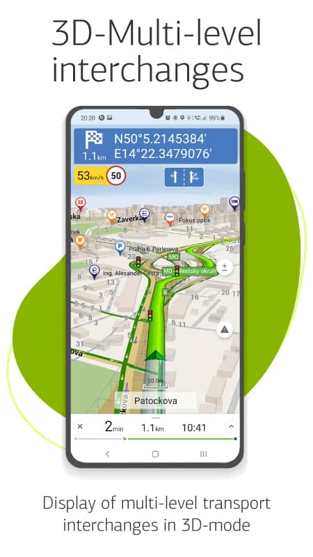
• 3D Road interchanges. Displaying multilevel road interchanges in 3D mode.
• Lane Assist. Route calculations taking multilane traffic into account and visual prompts while following the route
• Turn-by-turn voice guidance while moving along the route.
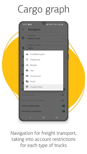
• Cargo graph: building routes considering road signs for cars from 3.5 - 20 tons, with the ability to customize the parameters of your vehicle and get a route that is relevant for a particular truck.
• Dynamic POI. Fuel prices, movies showtimes, and other useful information.
• Unlimited number of waypoints when building a route. Convenient route planning with an unlimited number of waypoints.
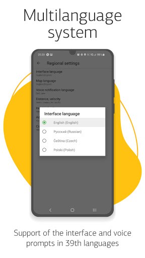
• Multilanguage. Support for interface and voice prompts in 39 languages.
• Customizable user interface. Ability to adapt the program interface and map display mode for your own needs.
• Purchases from the program menu. Purchase of new packs of maps and renewal of those already purchased from the main menu.
• Multitouch support. Quick access to map scaling and rotation functions via the multitouch input.
• Support for two navigation systems - GLONASS and GPS.
If you have any questions contact us: [email protected]. We will be happy to help you.